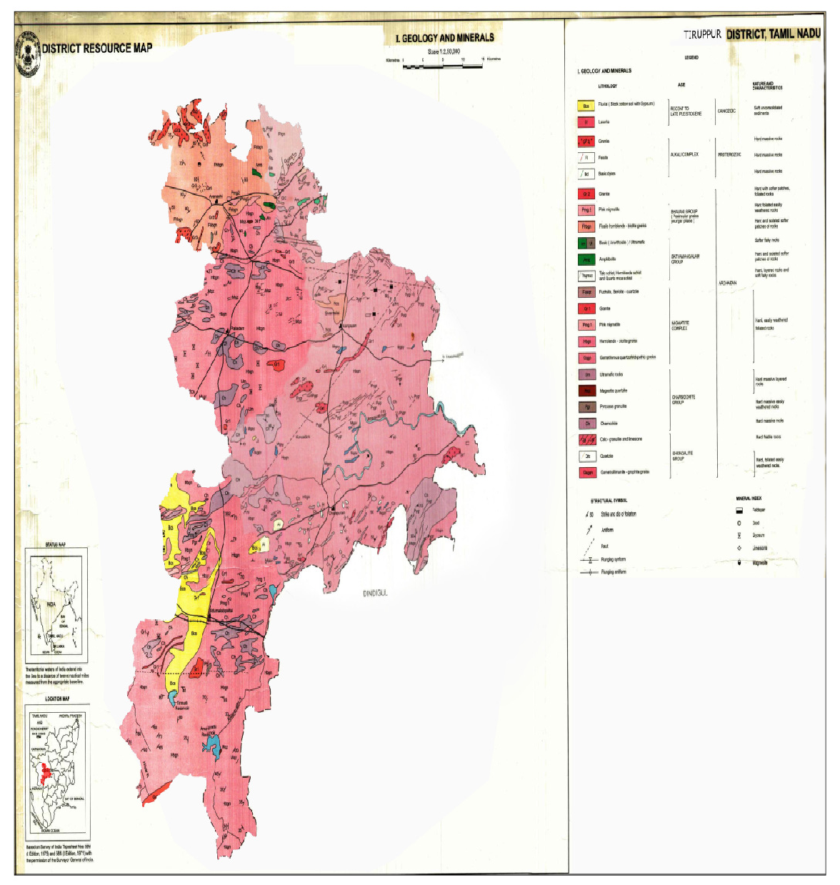
Tiruppur district of Tamil Nadu forms a part of southern Granulitic terrain and is predominantly occupied by crystalline rocks of Archaean to late Proterozoic age.
Regionally, the rocks can be grouped under five categories namely
Tiruppur District is predominantly occupied by hornblende Biotite gneisses of PGC (II) with enclaves of Magnetite Quartzite, Pyroxene Granulite and Charnockite. The area exposes several bands of Pyroxene Granulite which is medium grained, medium to dark grey in colour and stand out prominently in the gneissic country generally parallel to regional foliation. Charnockite is coarse grained, massive, many places it is foliated, grey coloured and greasy and exposed as bouldery outcrops and small knolls. It is well exposed in Central, Western and Southern parts of the Tiruppur District. The general strike of foliation varies from ENE-WSW,E-W with dipping towards NW and N respectively.
Hornblende-Biotite gneiss is well foliated, medium to coarse grained, pale grey and exposed as sheets and small knolls. Pink Granite gneiss occurs as thin bands and lensoidal bodies. It is a medium grained rock composed of alternating bands of mafic (mainly of biotite and hornblende) and felsic (Feldspar and Quartz) minerals. It is well recognized in Avinashi area.
Basic intrusives such as pyroxinite/dunite occurs as Outcrop and lensoidal bodies in the country rock and mostly concordant to the regional foliation. Many basic intrusive are reported in south and south-east of Tiruppur town. The trend of these bodies is east-west.
Nepheline syenite is a leucocratic, coarse grained rock and composed mainly of Feldspar with Nepheline and shows pitted appearance due to removal of Nepleline. This alkaline rock is available in and around Sivanmalai area only.
Acid intrusives comprising pink granite, pegmatite and quartz veins are traversed country rocks in micro (cm wide-meter long) to meso-scale (few meter wide and several meter long) extend. Granite is exposed around 9 km SW of Avanashi. Small scale pegmatite and quartz veins are noticed almost in all the rock types.
Acid intrusives are overlain by sediments of Quaternary age, represented by Kankar and black cotton soil with Gypsum. Most of the area is covered by brown and red brown soil. Some part of the area covered with black cotton soil contains Gypsum as lumps. Black cotton soil covers south-western part of the district.
Irrigation is the artificial application of water to the soil for normal growth of plants. Water is an important determinant factor for production of crops in agriculture sector. Intensive and extensive cultivation of land depends mainly on the availability of water. Medium and minor irrigation schemes are implemented in the state for augmenting the water supply for agriculture. The various sources of irrigation are canals, tanks, tube wells, ordinary wells, springs and channels. The following Table 63 shows the area irrigated in the District.
Irrigation of the Tiruppur District
| Irrigation | Area (‘000Ha) |
|---|---|
| Net Irrigated area | 119.3 |
| Gross irrigated area | 123.1 |
| Rain fed area | 72.9 |
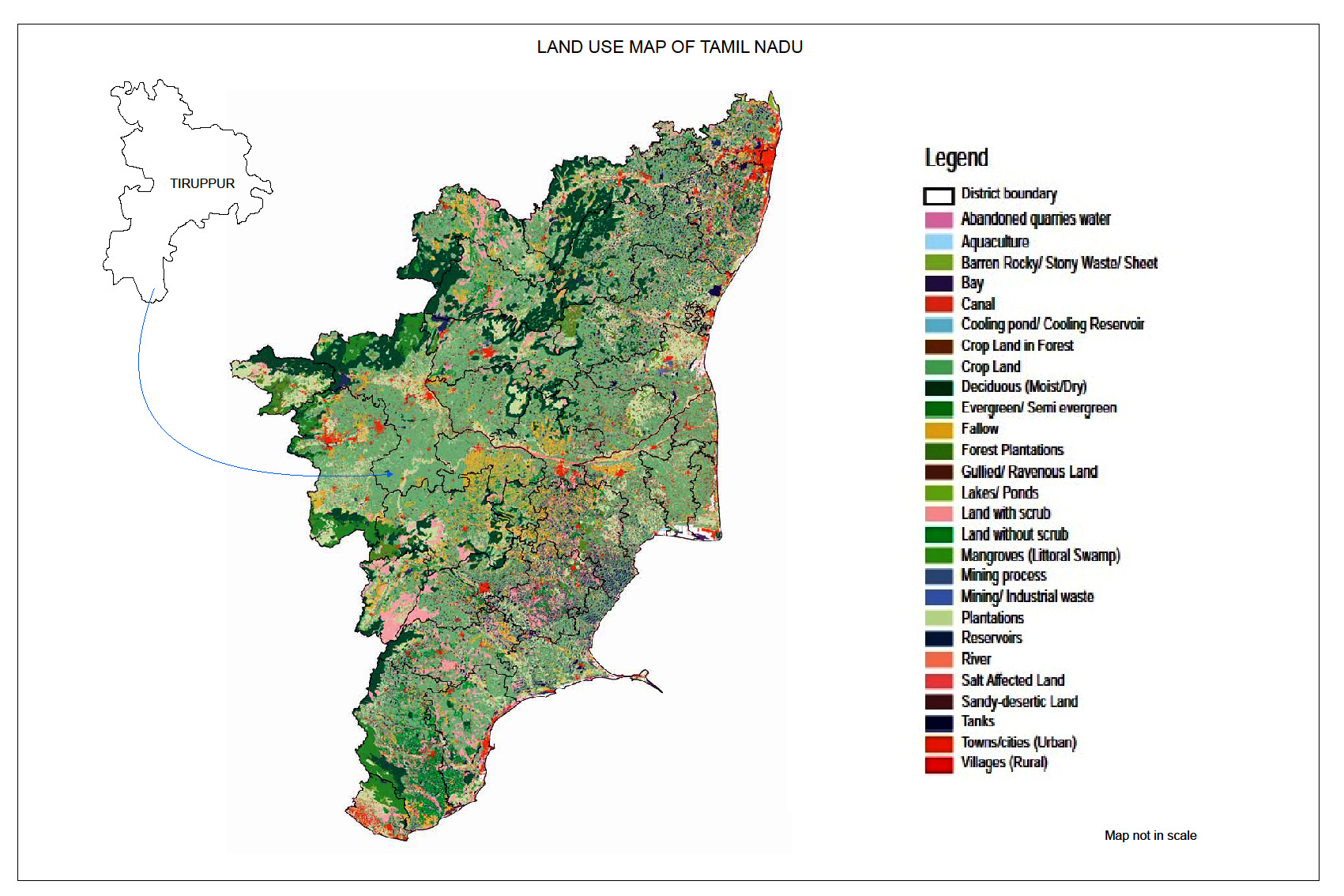
The Geographical area of Tiruppur is 5,19,559 ha. According to professional survey and also village records, the land use pattern during 2011 is indicated in the following Table
| Classification | Area in Hectare Classification of Tiruppur District |
|---|---|
| Total Geographical Area | 5,19,559 |
| Forest | 48,168 |
| Barren and Uncultivable uses | 2,541 |
| Land put to Non – Agricultural Uses | 68,677 |
| Cultivable Waste | 3,926 |
| Permanent Pastures and other gazing land | 126 |
| Land under miscellaneous trees crops and groves not included in Net area sown | 1,883 |
| Current fallows | 91,152 |
| Other fallow land | 1,07,985 |
| Gross | 1,07,985 |
| Net area sown | 1,95,101 |
| Gross Area sown | 1,99,918 |
The area receives rainfall through both south-west and north-east monsoons.About 40 percent of the precipitation is contributed by south-west monsoon and northeast monsoon accounts for 50 to 60 percent. The average annual rainfall for the basinarea is 720 mm.
The basin area experiences tropical climate being hot and dry for the greater part of the year. The period from March to June is generally hot. The temperature ranges from 20° to 38°C