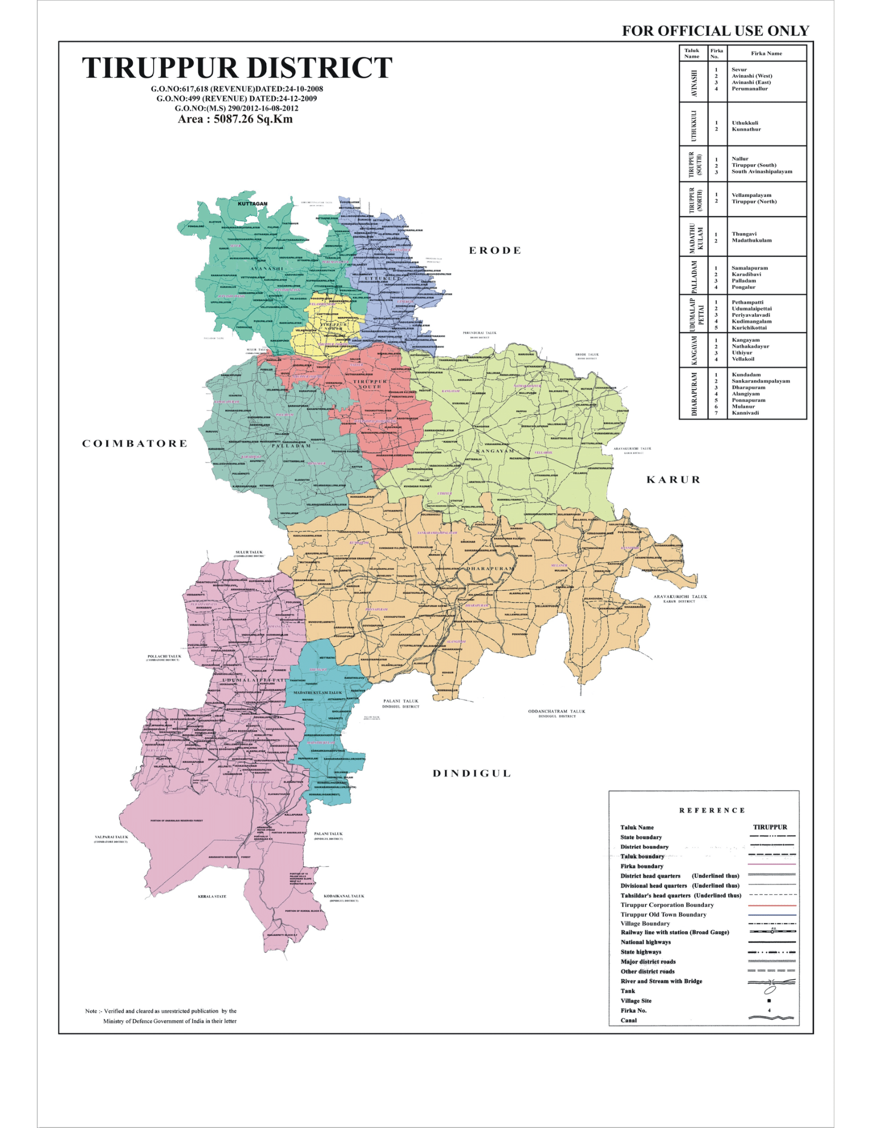
Tiruppur district lies on the western part of Tamil Nadu bordering the Western Ghats and hence the district enjoys a moderate climate. The district has an area of 5187 sq. km. The southern and south western parts of the district (Madathukulam and Udumalpet) enjoys maximum rainfall, due to the surrounding of western ghats. The rest of the district lies in the rain shadow region of the Western Ghats and experiences salubrious climate most parts of the year, except the extreme east part of the district. The mean maximum and minimum temperatures for Tiruppur city during summer and winter vary between 35 °C to 18 °C. The average annual rainfall in the plains is around 700 mm with the North East and the South West monsoons contributing to 47% and 28%, respectively, to the total rainfall. The major rivers flowing through the district are Noyyal and Amaravathi. The Amaravati river is the main source of irrigation in the district. Amaravathi Dam, which created Amaravathi Reservoir, is located at Amaravathinagar. Thirumurthy dam which is created by the PAP project is situated in this district. Both Amaravathi dam and Thirumurthy dam are the prime source of irrigation in the district, whereas Uppaar dam is another dam which receives water from seasonal rains.